
GIS built for substantial work.
Explore, edit and process spatial data through a Windows workstation with MapLibre views, local GIS services, documented sources and growing geoprocessing tools.
Geospatial software, GeoAI and digital-twin technology built in Africa for infrastructure, cities and source-aware spatial decisions.
GeoTwins Africa is building AGOT. A Cross Platform Desktop GIS workstation evolving into a local-first GeoAI and digital-twin platform for infrastructure and cities.
GeoTwins Africa is a product-led geospatial technology company. Begin with a sector problem, explore the developer ecosystem or inspect reproducible methods. Product capabilities are defined by their released and tested maturity.
Verified GIS Hosts / SDK 0.8.0 packages cover QGIS, ArcGIS Pro and the standalone Python SDK. The shared GeoAI Core adds durable, source-bound local GIS workflows; the current published notes explain operational limits and host-specific acceptance.
Published 0.8.0 preview.1 · verified public assets
AGOT Desktop 1.0.8, GeoAI Hosts & SDK 0.8.0 and GeoTwins Harness 0.8.0 have separate public release channels, installation files and versioned documentation. Review each current GitHub release before testing.
Explore, edit and process spatial data through a Windows workstation with MapLibre views, local GIS services, documented sources and growing geoprocessing tools.
PostGIS, GDAL, GEOS and PROJ support spatial data workflows, alongside bounded TERRALUX Rust kernels for 3D geometry and DEM analysis.
Scene history and source-grounded scenarios lay the groundwork for world registries, GeoAI, generation, simulation and connected real, synthetic and hybrid worlds.
See the current GIS interface and the engineering foundations of the wider platform. This is an authentic development capture, not an imagined product screenshot.
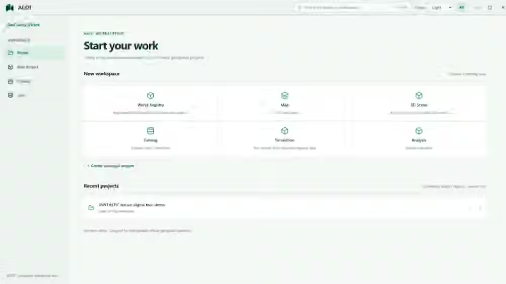
Windows workspaces, mapping, source-backed editing and the evolving GIS toolbox documented in published previews.
PostGIS, native TERRALUX Rust kernels, 3D/terrain paths and versioned geospatial evidence under development.
Expanded GeoAI, generators, simulations, cross-world links, high-volume scenes and plugin governance remain objectives.
AGOT connects professional GIS, local spatial processing, 2D/3D scenes and versioned geospatial evidence. Its broader architecture is growing toward many independent worlds, model-assisted analysis, reproducible simulation and interoperable spatial systems.
Geographic outlines unavailable. The grid is illustrative.
Asset records and field evidence, connected by place.
An asset register and dated inspection records.
GIS, GeoAI and digital-twin workflows. Built to grow.
Change, in perspective.
Beyond a single dimension.
A place for every address.
The city, considered.
05 products · 1 public AGOT release · 4 restricted pilots.
GIS Assistant, Hybrid Map Viewer, Street AI Mapper and Physical Planning Assistant are restricted pilots available for scoped evaluation and collaboration; they have not been discontinued or made freely downloadable.
Progressive release gates—not invented deadlines. Public availability, source implementation and planned capabilities are deliberately distinguished.
Professional GIS with Concept 6 workspaces, Map/Edit/Imagery, authenticated GIS jobs, source-backed World state, TerraLux/Rust tooling and developing Three/Cesium 3D pathways.
Windows x64 MSI · GitHub prerelease published · installed acceptance continuesQGIS plugin, ArcGIS Pro .NET add-in and Python toolbox, and independent SDK ZIP/wheel. Standalone native GIS and reviewed local Ollama planning; connected AGOT mode optional.
Five published host/SDK binaries · manual upgrades · host acceptance ongoingScalable city/3D Tiles and IFC pipelines, replayable AI tool harnesses, bounded GPU execution, temporal source histories and more complete scenarios/simulation disciplines.
Source and integration tests in progress · no blanket field certificationNative cross-platform packaging, portable GIS/PostGIS service runtime and signing, followed by clean-install, upgrade, GPU and real-workflow testing before public previews.
2027 engineering target · subject to validation, not a guaranteed ship dateAGOT Desktop's latest Windows installer and the independently versioned GeoAI Host/SDK packages are verified from GitHub before downloads.
Windows preview ↗AppImage / DEB planned. Native service, GDAL/PostGIS bundling and distribution tests underway.
Not yet downloadableDMG/app bundle targets. Native runtime adaptation, Apple signing and notarization remain mandatory.
Not yet downloadableGeoTwins Africa, a brand of Aero Establishments, brings together geospatial engineering, Earth observation, software and spatial planning. We develop reusable products and deliver project-specific analysis, data systems, prototypes and technical collaboration.